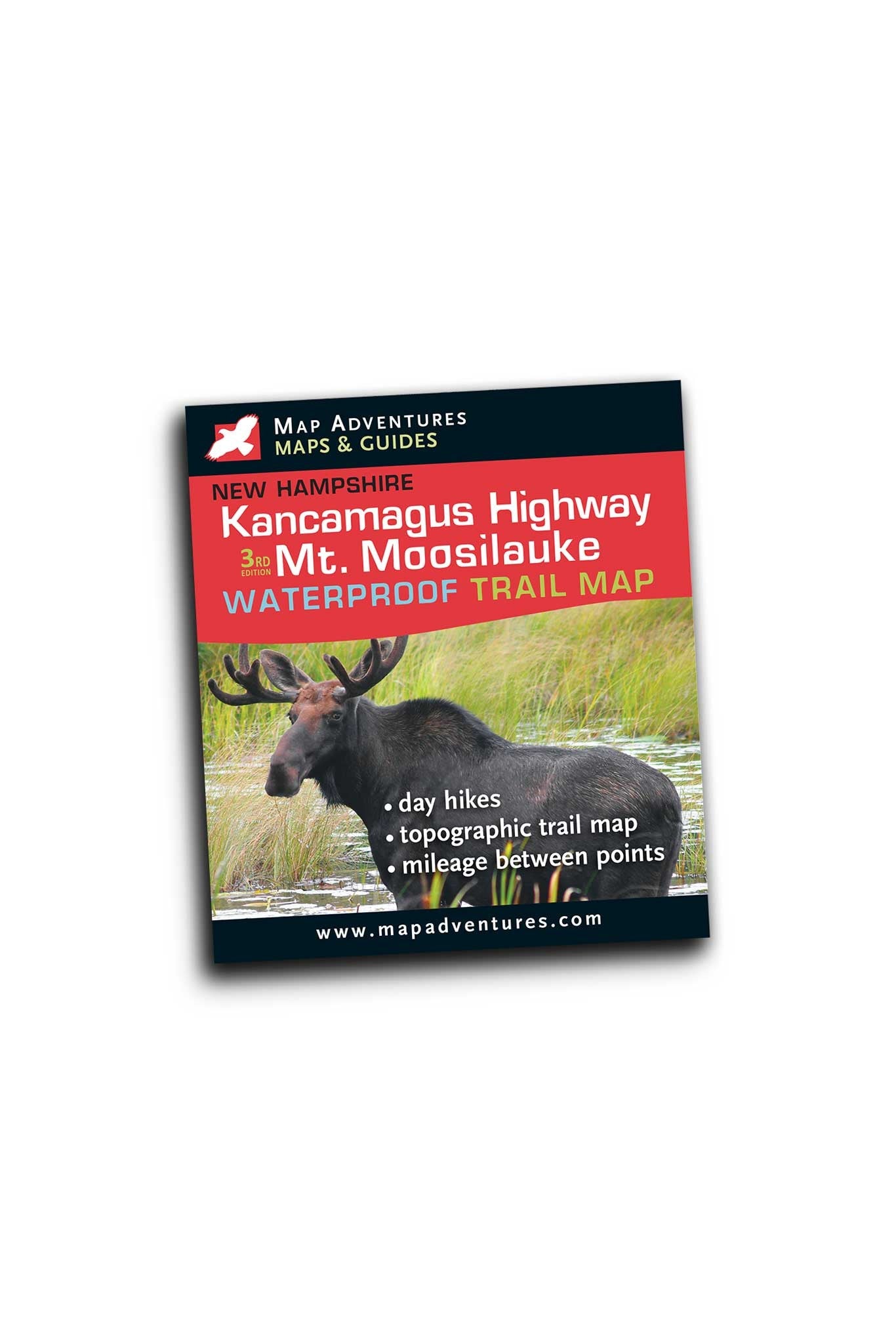

Map Adventures
Kancamagus Highway & Mt. Moosilauke
- Regular price
- $4.95
- Sale price
- $4.95
- Regular price
Couldn't load pickup availability
Description
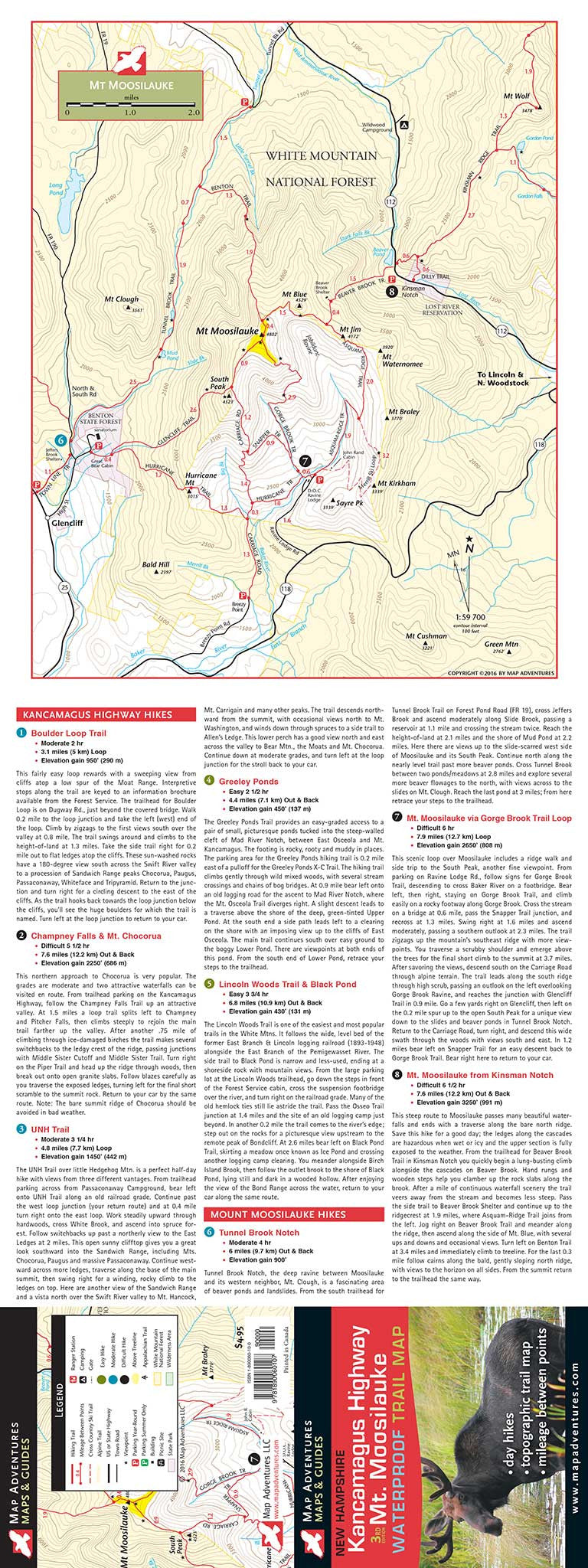
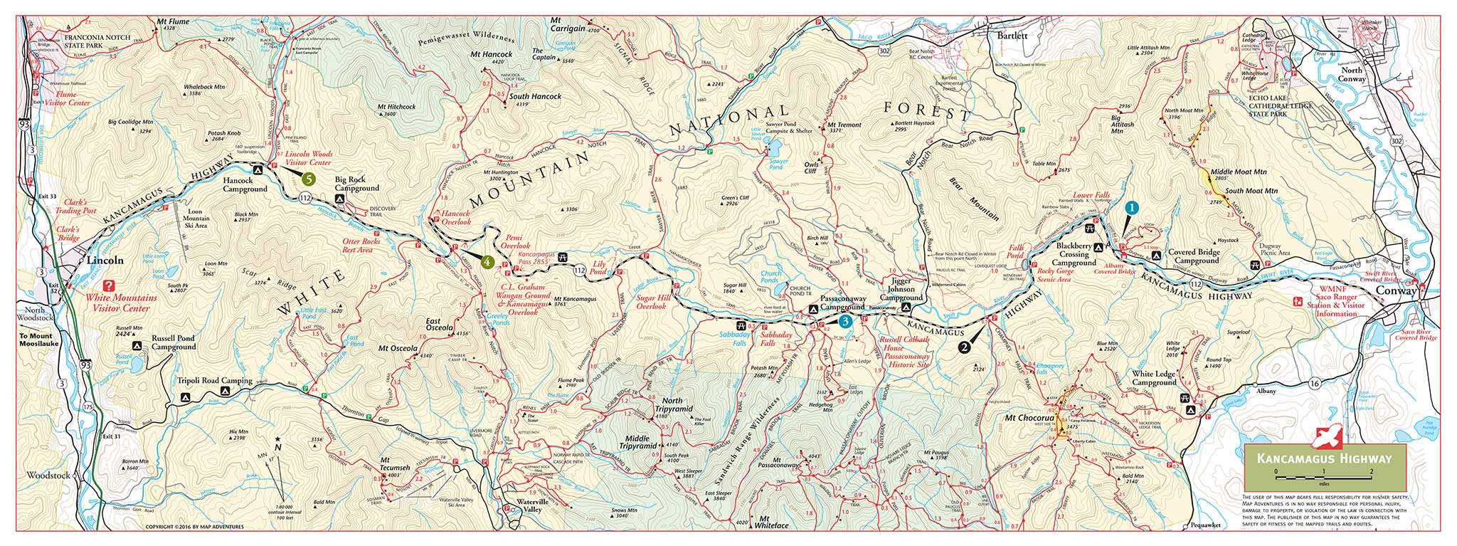
Kancamagus Highway, stretching 34 miles from Conway to Lincoln, is one of the most beautiful and popular drives in the East. Unbroken forests, high mountain vistas, rocky streams, and frequent moose sightings are among the many attractions of this National Scenic Byway. The road attains its highest elevation – 2855 ft. - at Kancamagus Pass, marking the divide between the Saco and Merrimack watersheds.
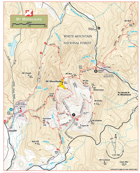
Mt. Moosilauke, at 4,802’ is the tenth highest and most southwesterly of the 4,000 foot summits in the White Mountains. In good weather there are great views into Vermont to the west. This Gentle Giant has been climbed by local for many years.
Map Features
- Suggested Day-Hikes
- Campgrounds
- Parking and overlooks
- Trail mileage between points
- Detailed cartography
Areas Covered
- Mt. Moosilauke
- Kancamagus Highway – from Conway to Lincoln, NH
Map Guide: Waterproof | 24" x 9" unfolded | ISBN 978-1890060107 | Scale 1:78 000 and 1:59 700 | Map Adventures LLC
Frame
Discover our innovative product that blends cutting-edge design with unmatched functionality. Crafted for those who value quality and performance, it offers a unique experience you won’t find elsewhere. Elevate your everyday—check it out and see the difference.
Lens
Discover our innovative product that blends cutting-edge design with unmatched functionality. Crafted for those who value quality and performance, it offers a unique experience you won’t find elsewhere. Elevate your everyday—check it out and see the difference.
Size
Discover our innovative product that blends cutting-edge design with unmatched functionality. Crafted for those who value quality and performance, it offers a unique experience you won’t find elsewhere. Elevate your everyday—check it out and see the difference.